


Each spring, before the cars return and the crowds take over, a fleeting window opens when Glacier National Park’s iconic Going-to-the-Sun Road belongs solely to cyclists and hikers. The opportunity to pedal one of the most spectacular alpine landscapes in North America, free from vehicle traffic, is becoming more popular every year. Matt Hudson shares the experience of tackling the climb, savoring the descent, and reflecting on the joy – and growing challenges – of accessing this treasured route.

Going-to-the-Sun Road
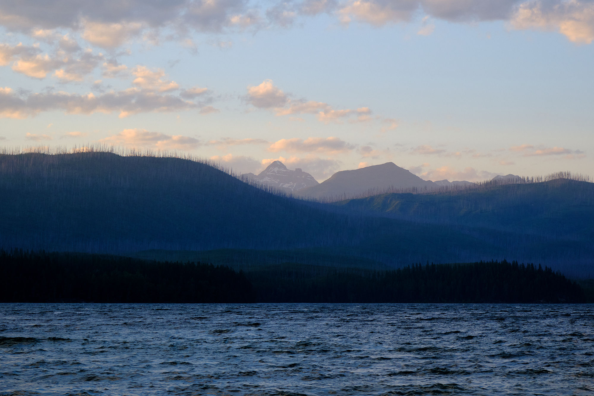
Going-to-the-Sun Road was one of the first national park roadways to “accommodate the automobile tourist,” as the Federal Highway Administration put it. It runs 51 miles and gains more than 3,000 feet to provide access to some of the most spectacular mountain scenery in the world. The road is a centerpiece attraction for Glacier National Park in Montana.
The road has become extremely popular with drivers in a way that’s arguably detrimental to the park experience. Each spring, communities around Glacier watch the progress as spring melt and snowplows restore access for the new year. Once the road opens to vehicles, usually in late June, it’s inundated with vehicle traffic. Drivers are sightseeing in bumper-to-bumper traffic and negotiating uncomfortably tight turns with oncoming RVs as one of 8,000 daily vehicles on that single road. It got bad enough that the park recently instituted a reservation system to make the drive. Parking, as you might imagine, is limited.
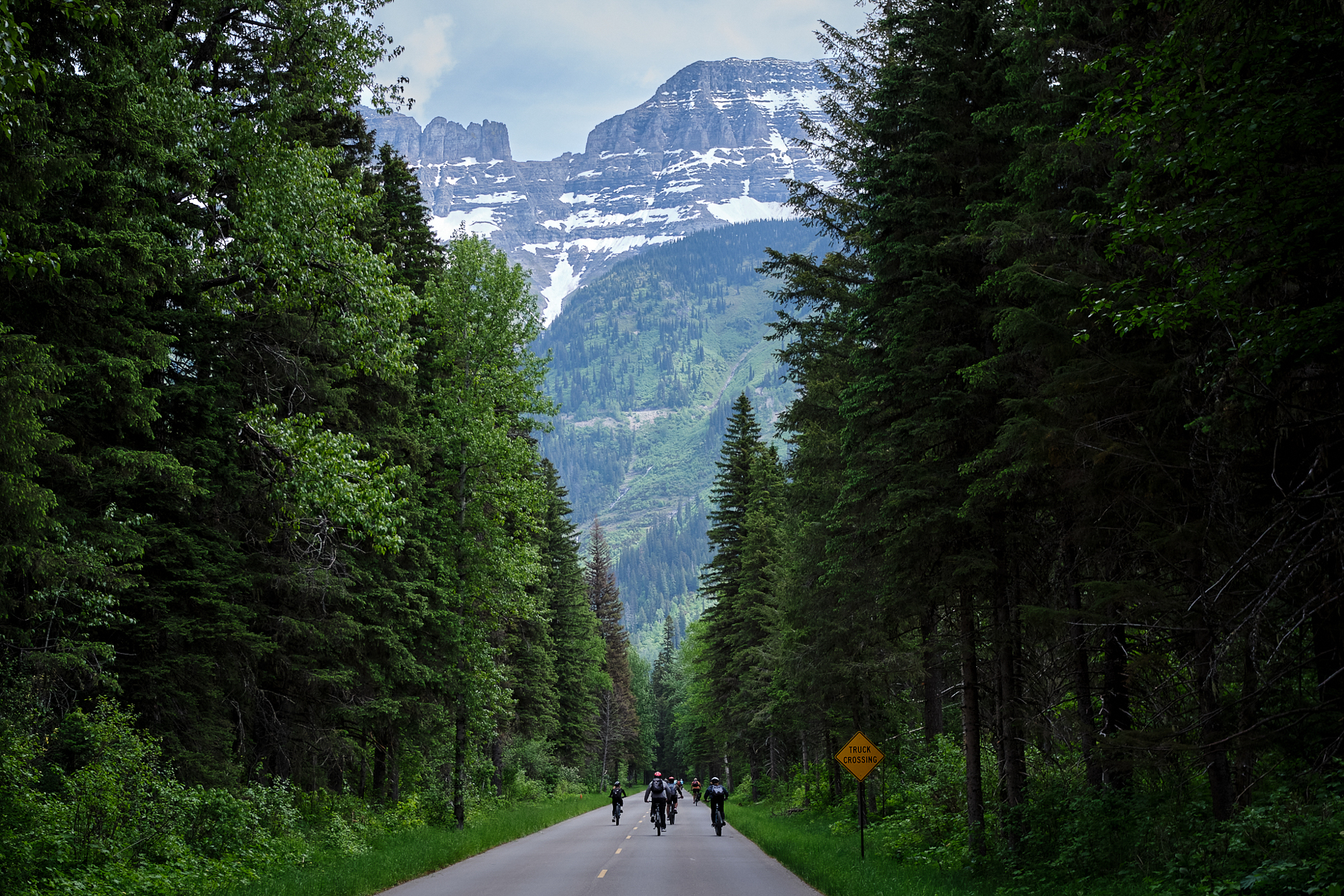
But for a few glorious weeks in the springtime, the west side of Going-to-the-Sun Road is closed to vehicles and accessible only on foot or bicycle. Depending on the snow conditions (including avalanche danger), you can ride somewhere around 30 miles and gain 3,000 feet in elevation up to Logan Pass atop some truly blessed pavement. There’s little or no pedaling necessary on the way down.
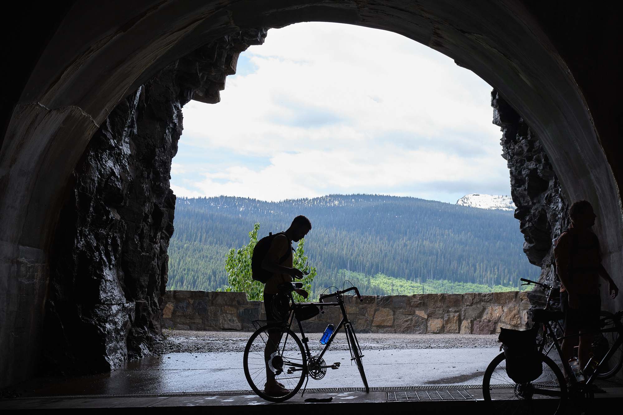
I rode Going-to-the-Sun Road for the first time in early June. It felt forbidden, too good to be true, for that route to be a bicycle trail. And given how popular the bike ride has become in addition to the maxed-out vehicle season, I felt like I was getting in on something great just before another big change.


Any Bicycle is a Good Bicycle
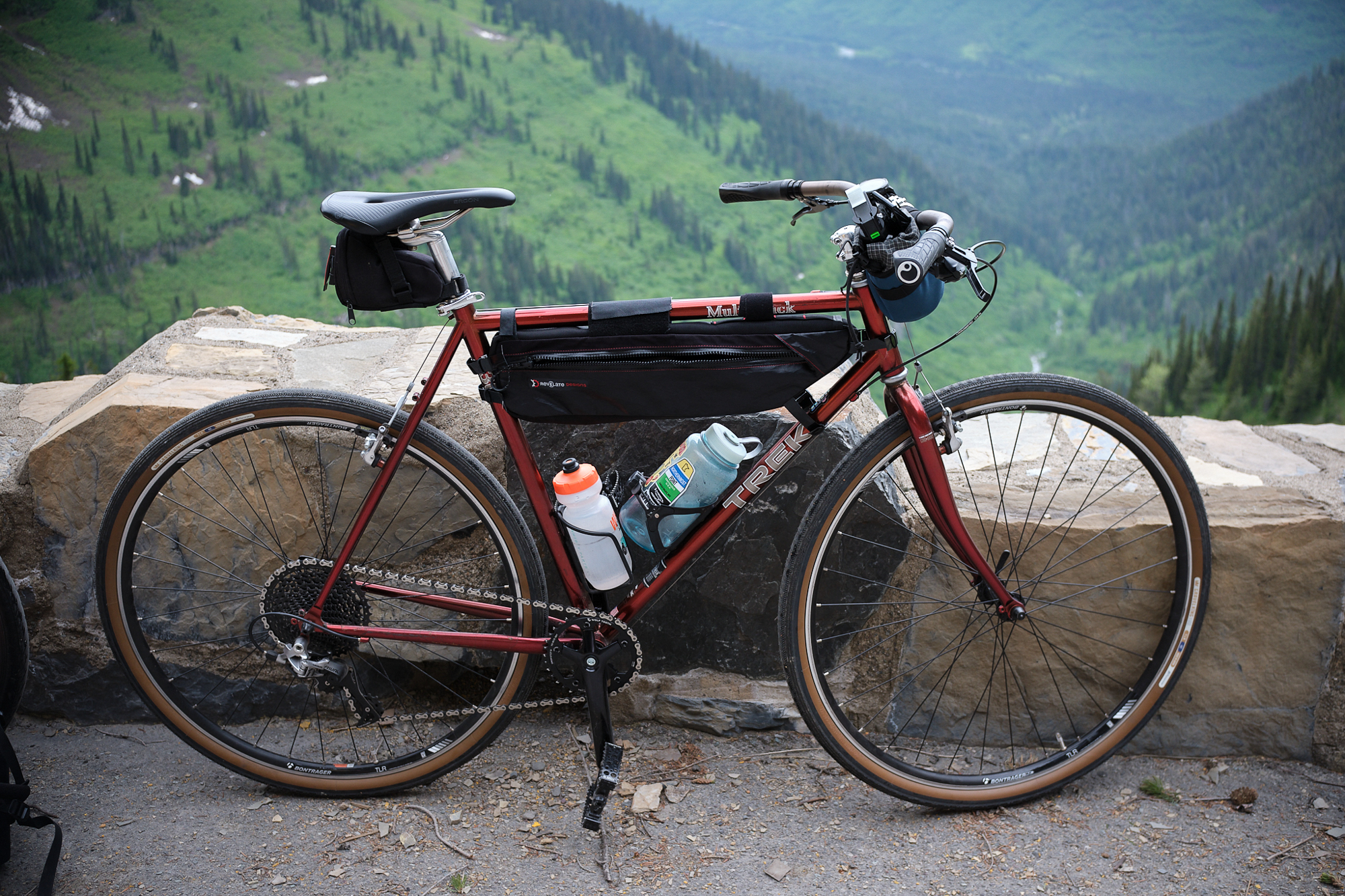
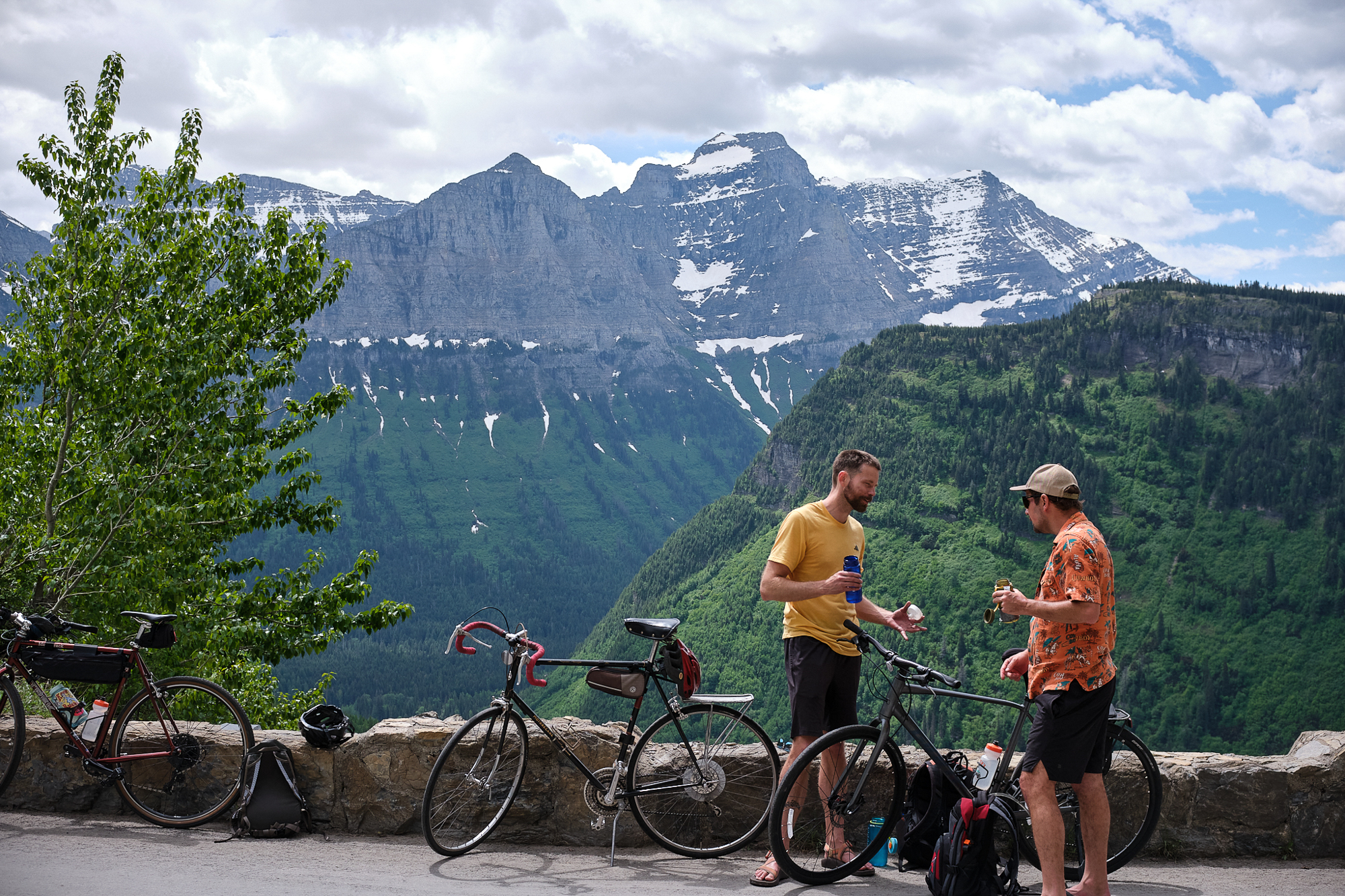
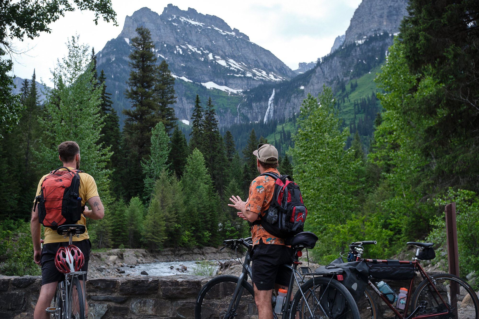
I live in Great Falls, Montana, which is about three hours from the west side of Glacier National Park. I joined two friends and fellow journalists who drove up from Missoula for the ride. We took a pretty casual approach to what I considered to be a strenuous ride. Dave was on a sturdy Giant Escape that seemed pretty well-suited to the task. I joined him in the “hybrid bike” class with a modified 1996 Trek 730 Multitrack that’s been my main ride for the past few years. I swapped in a 1x drivetrain this spring and was thanking my former self during the climb for going with the 36t chainring rather than a 40 or 42.
Friend No. 2, Sam, brought along his Motobecane Super Mirage that looked to be of ‘70s vintage and was in usable but very used condition. This bike was heavy, and we reminded him at the last minute to leave behind his U-lock to shave a pound or two. I glanced over at one point to see his chain take on a significant droop while on the small chainring. Nonetheless, Sam didn’t complain about the ride at all. He had no mechanical issues and went on a hike the next morning.

The Route
The route for most riders started at Avalanche Campground, elevation 3,370 feet. Some riders started farther back, adding good miles to the overall day, but they had to reach the road closure alongside vehicle traffic on a road with no shoulders. Parking at Avalanche was a mess even in this shoulder season.
At the start of the ride, we heard that you could get as far as the Triple Arches, an old road support built into the side of a steep cliff that is about 14 miles from Avalanche Campground. As the day progressed, we heard that the road was open up to Logan Pass, the highest point of the road at 6,600 feet. That became the goal.
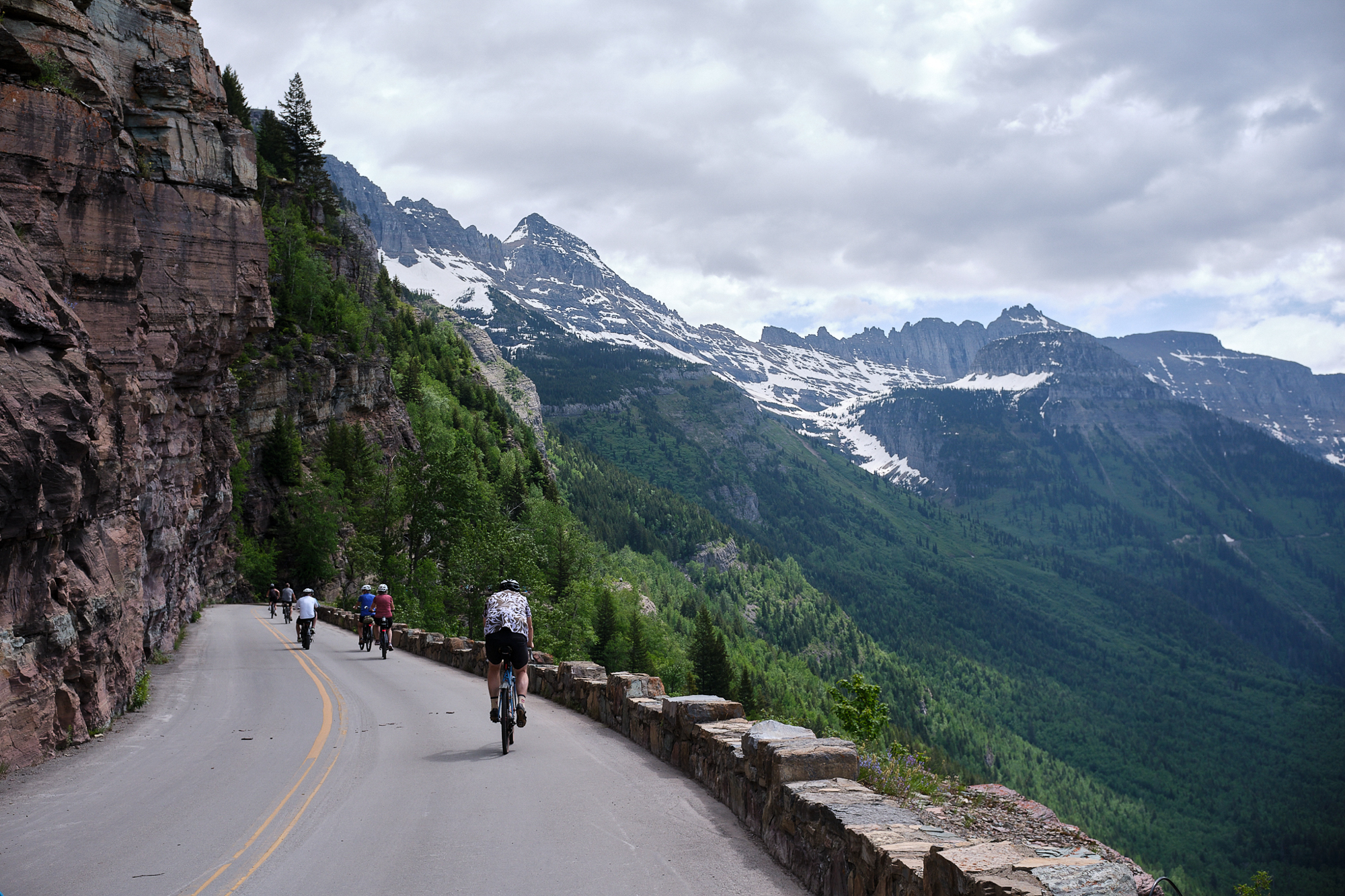
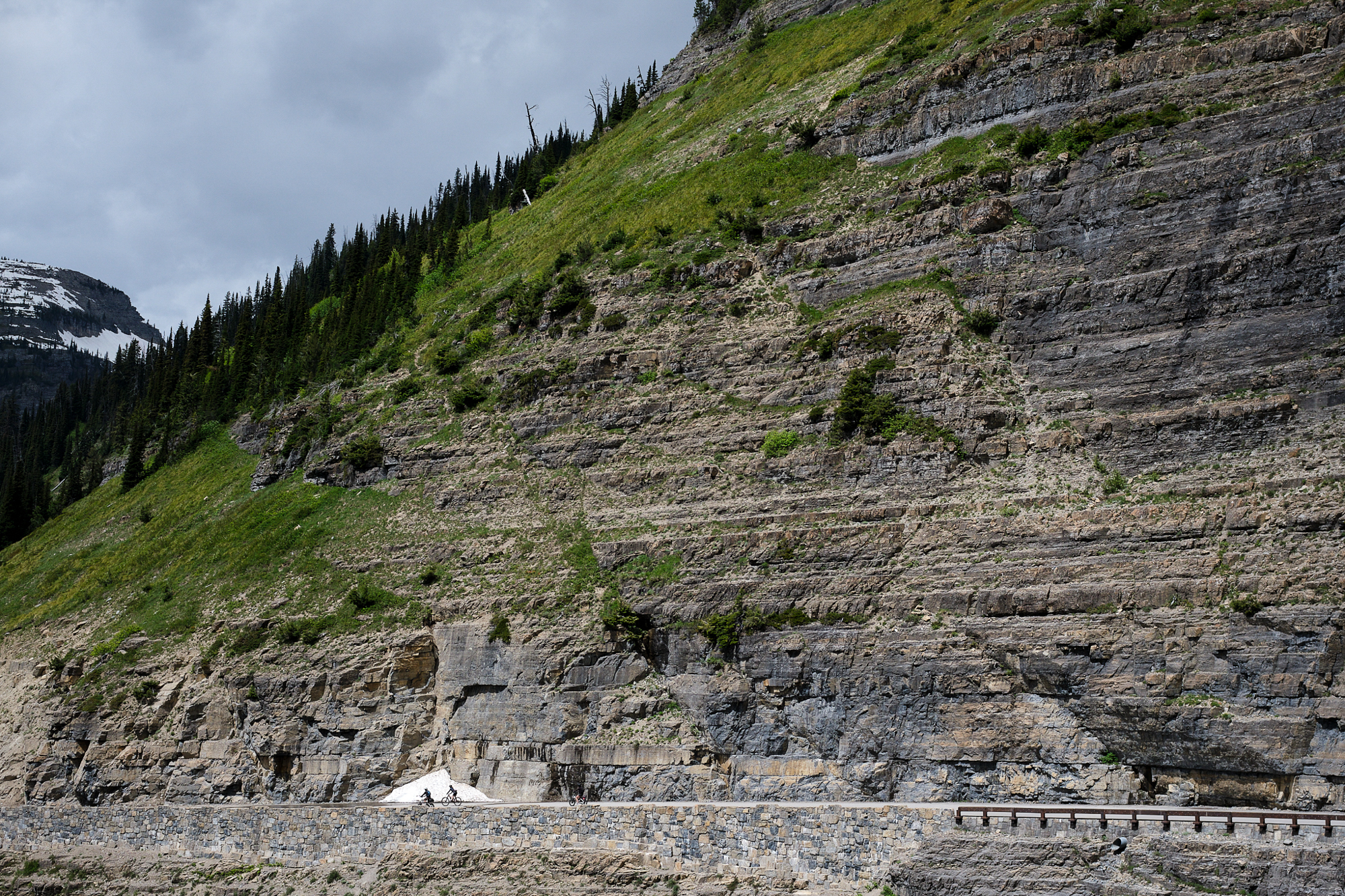
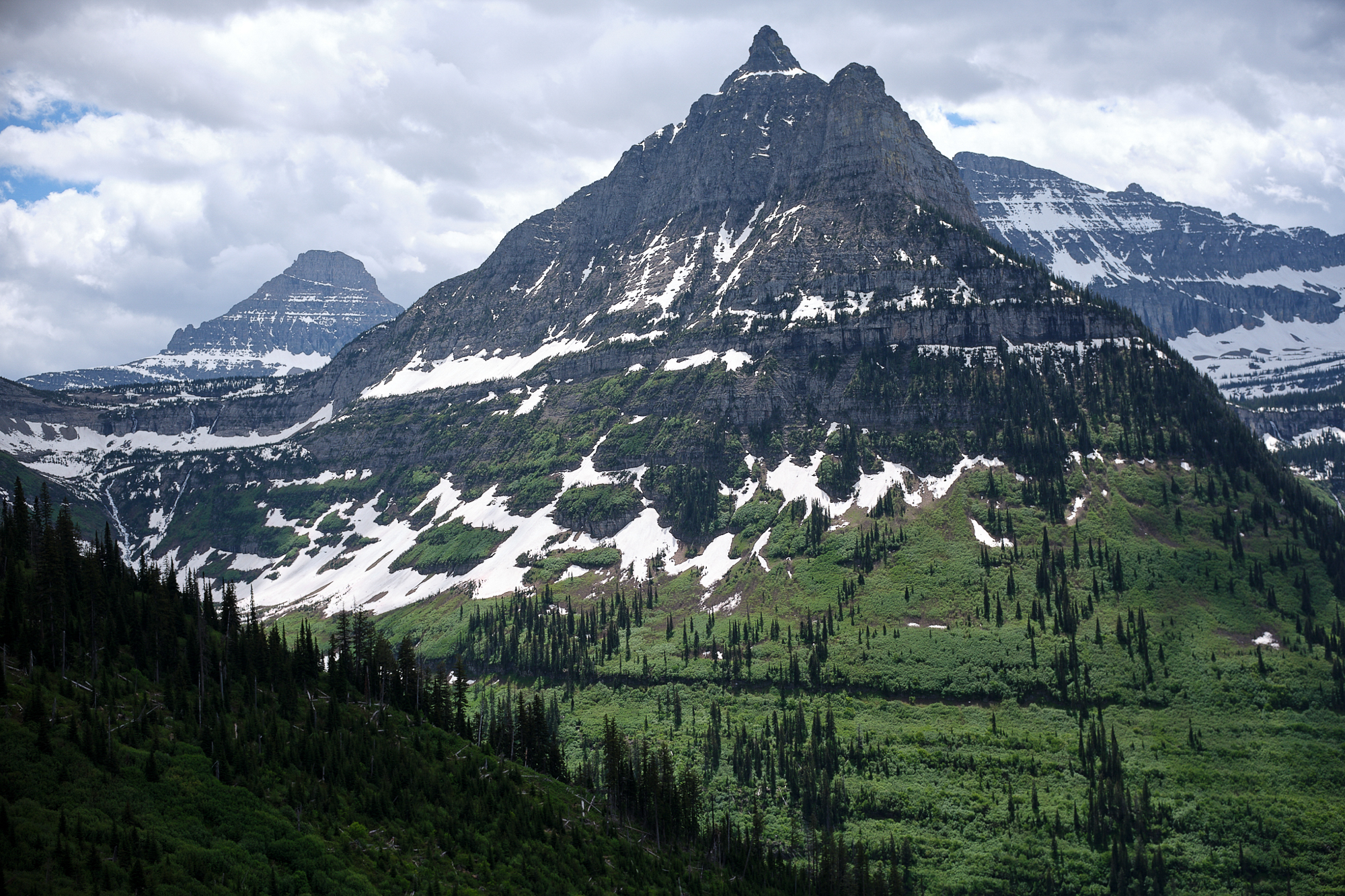
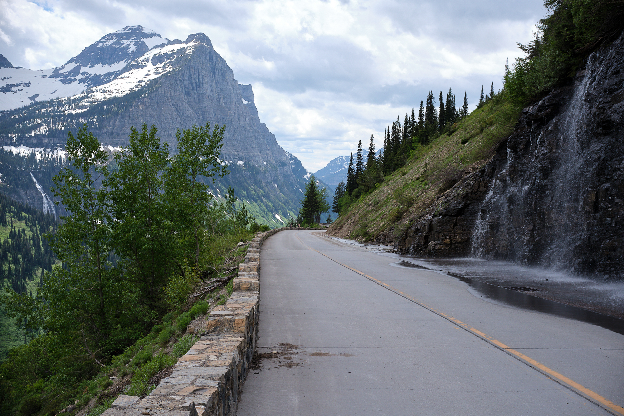
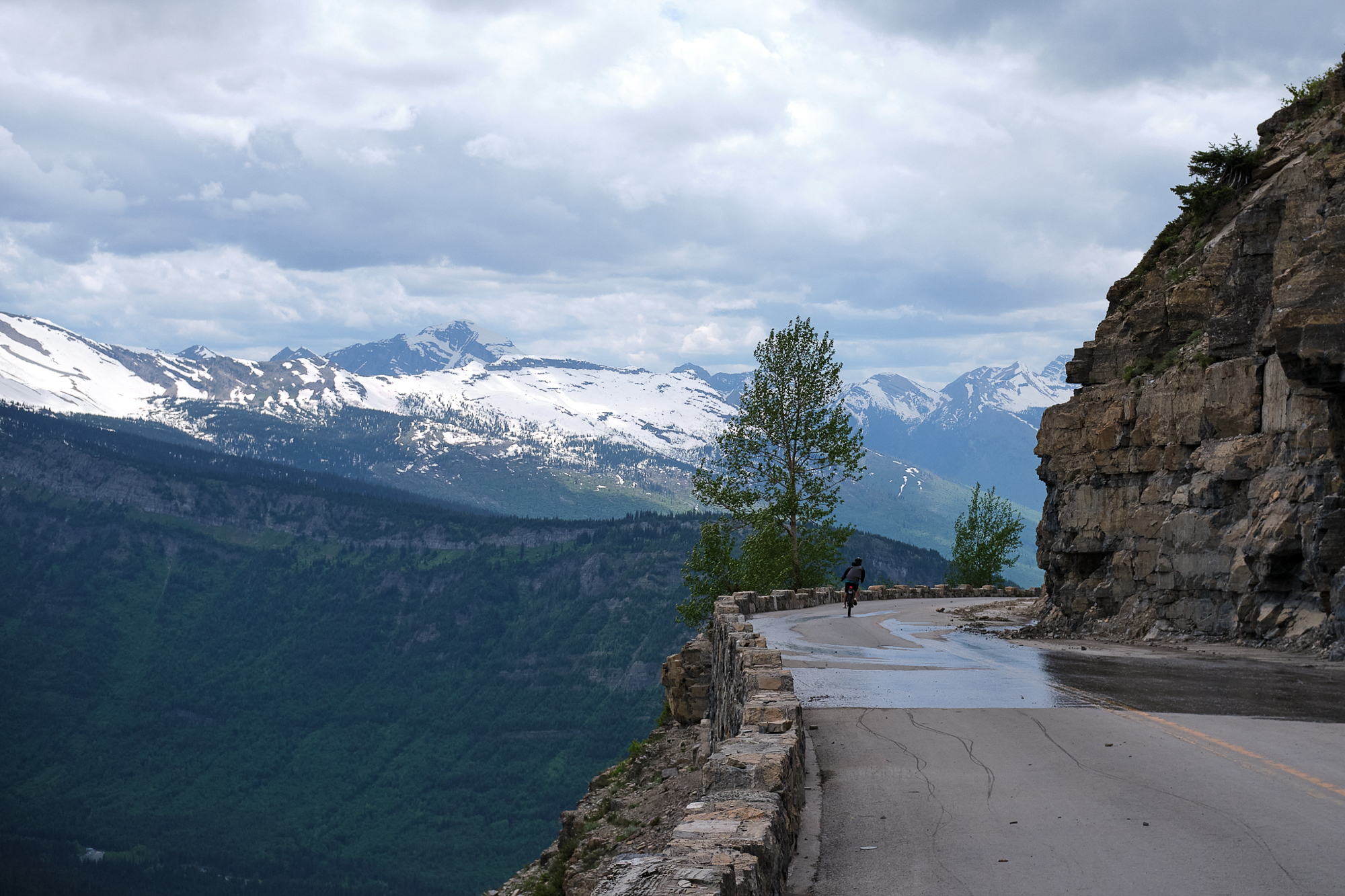
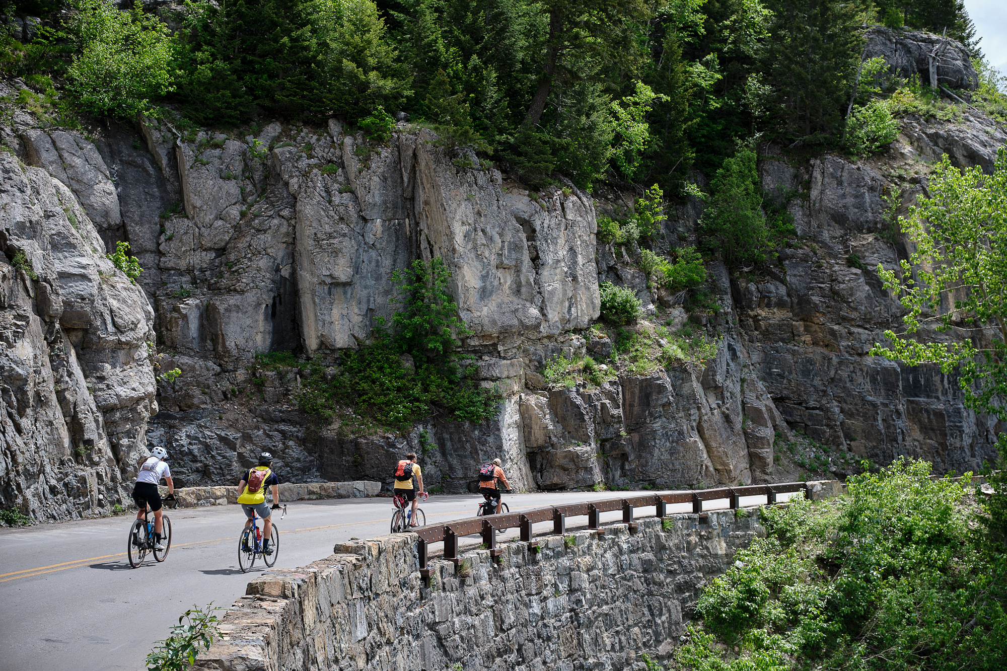
The overall ascent is an average 5.7% grade, according to one source. The first stretch was mellow, winding through the trees along the clear, snow-melt waters of McDonald Creek. We made slow and steady progress with lots of breaks. Taking 15 minutes or so really helped out my legs as we got farther up. The road climbed out of the valley floor and began hugging the mountainside. For much of the route, a stone barricade just a few feet tall separates any road occupants from a sharp, perilous fall. After about eight miles, we made it to The Loop, the main road switchback and a gathering spot for riders at around 4,200 feet.


A History Lesson
Going-to-the-Sun Road was built over about a decade in the 1920s and ‘30s. To plan the route that would become the “transmountain highway,” surveyor Frank A. Kittredge and his team climbed 3,000 feet daily to reach the higher sites. This anecdote about the survey is often cited alongside the fact that the survey team had a 300% turnover rate over three months. Three men died during the road construction phase.
The name, Going-to-the-Sun, is named after a nearby mountain that figures into a story about the Sour Spirit, who taught Blackfeet braves to hunt. The National Park Service account suggests that the tale may have come from a white 19th-century settler rather than the tribe. Nevertheless, it’s important to acknowledge that this incredible landscape is part of the ancestral lands of the Blackfeet, Salish, Pend d’Oreille, and Kootenai indigenous tribes.
Today, the park borders the Blackfeet Reservation to the east. A short distance southward from the park is the Flathead Reservation, home to the Confederated Salish and Kootenai Tribes.


Sharing the Joy
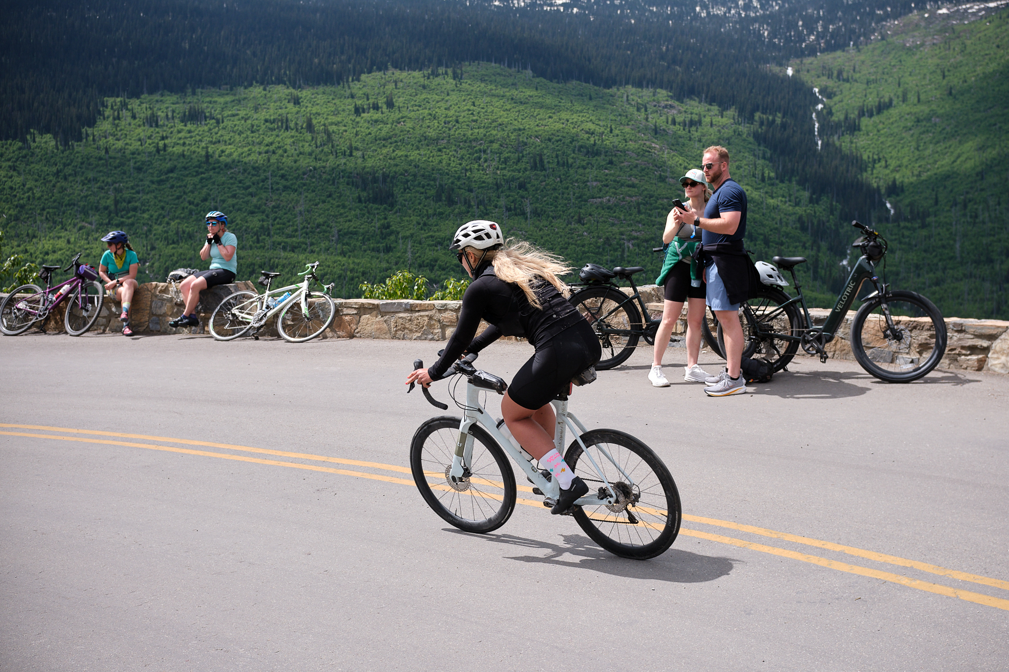
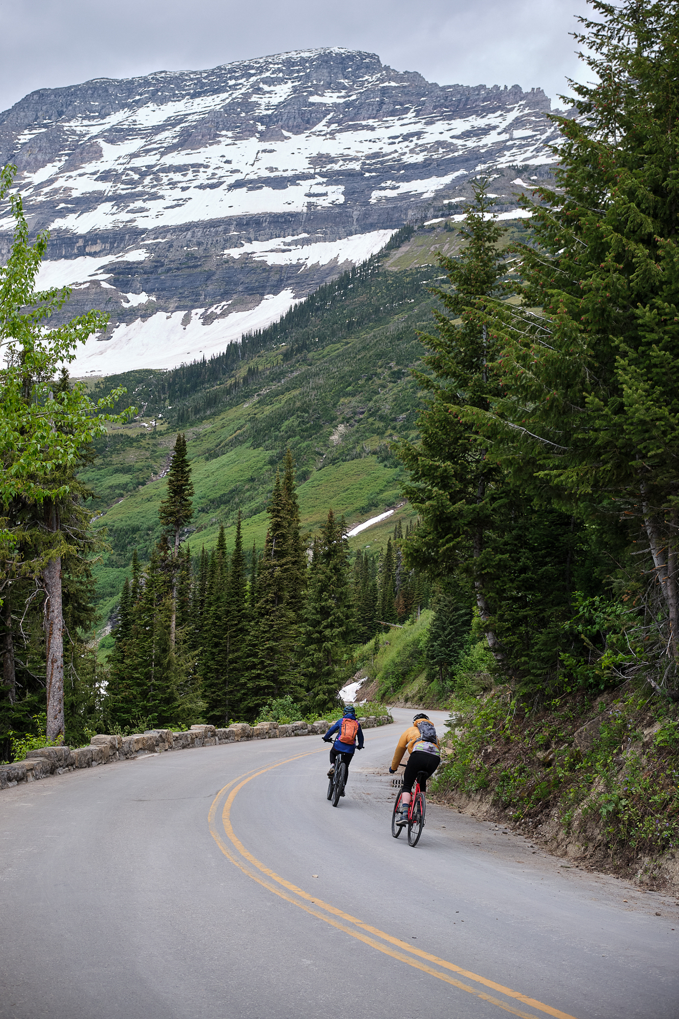
The miles came much slower after The Loop. Though I’m an avid cyclist, I’ve never been an aggressive rider and extended climbs don’t agree with me. The scenery helped to keep my mind off my legs. And the stoke factor was undeniable. So many different riders – young and old, beginner and seasoned – were out enjoying this cycling event. Given the excellent trail environment in northwest Montana, I saw lots of mountain bikes taking on the all-paved route. They’re used to climbing, I figured. There were lots of gravel and road riders, many of whom zipped past us on their way up. As I made my climb, I liked seeing and listening to the speedy descenders. Those with well-tuned bikes and no loose clothing to flap in the wind made a satisfying shhhoooopp sound as they screamed by. It sounded like dropping an aerodynamic pebble into the water.
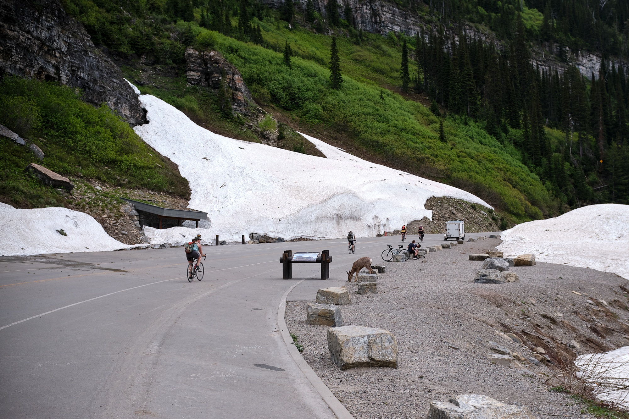
As you might expect, there were lots of e-bikes. They actually made up the majority of bikes that day. There might be lots of opinions about that. The park does have an official motor limit of 750 watts and requires the power to engage only while pedaling. It certainly contributed to the crowds, which have grown for this springtime ride in recent years. There are plenty of outfitters just outside the park with fleets of rentals.
During my ride, the e-bike crowd really just added to the joy of it all. I saw lots of families enjoying the experience. There are few parents who will make the journey with a Burley under their own power (though many kudos for those who do). Traveling this road on a bike is just so much better than by car, and I’m glad those people got to experience that. They otherwise may not get the chance without an e-bike.
And if I’m being honest, the presence of so many e-bikes kind of solidified the unspoken bond between the humans powering their own ascents (shout out to the dude on the Black Mountain Cycles Monstercross who responded to my “steel is real” comment). Whether or not you’re used to climbs like that, it ain’t easy.
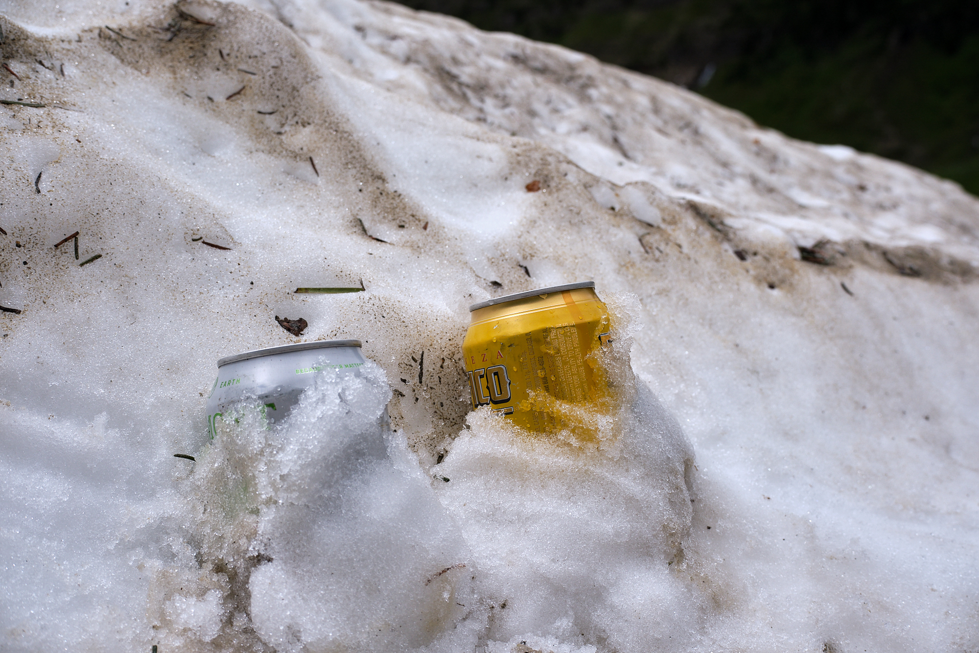
Along the route, we passed a few park rangers who had treed a small bear. A ranger told us that it stole someone’s backpack for the second time in a week or two. That behavior had to “be corrected,” and I’m not sure what specifically that meant for the bear. Sometime later, one of the rangers passed us on an e-bike. He said that they were closing the road to riders due to this bear activity. He was heading to the top of the road to start, and he told us we could continue along until he started coming back down.
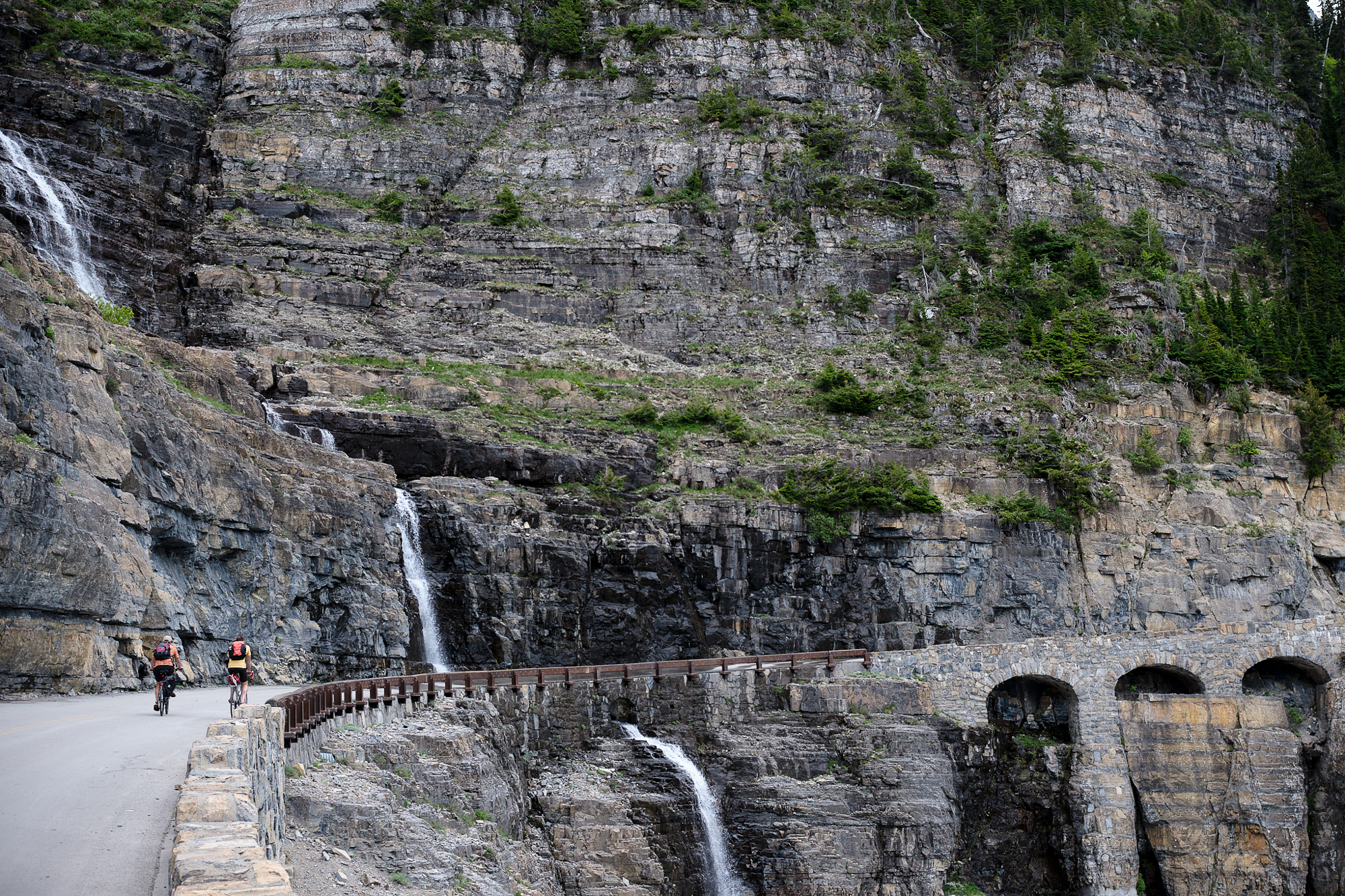
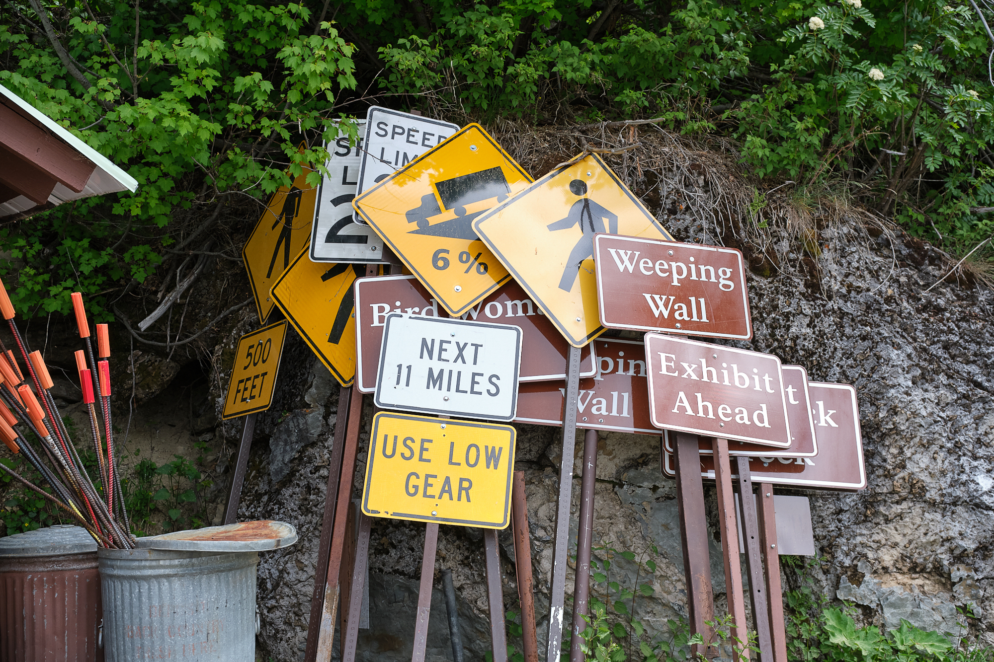
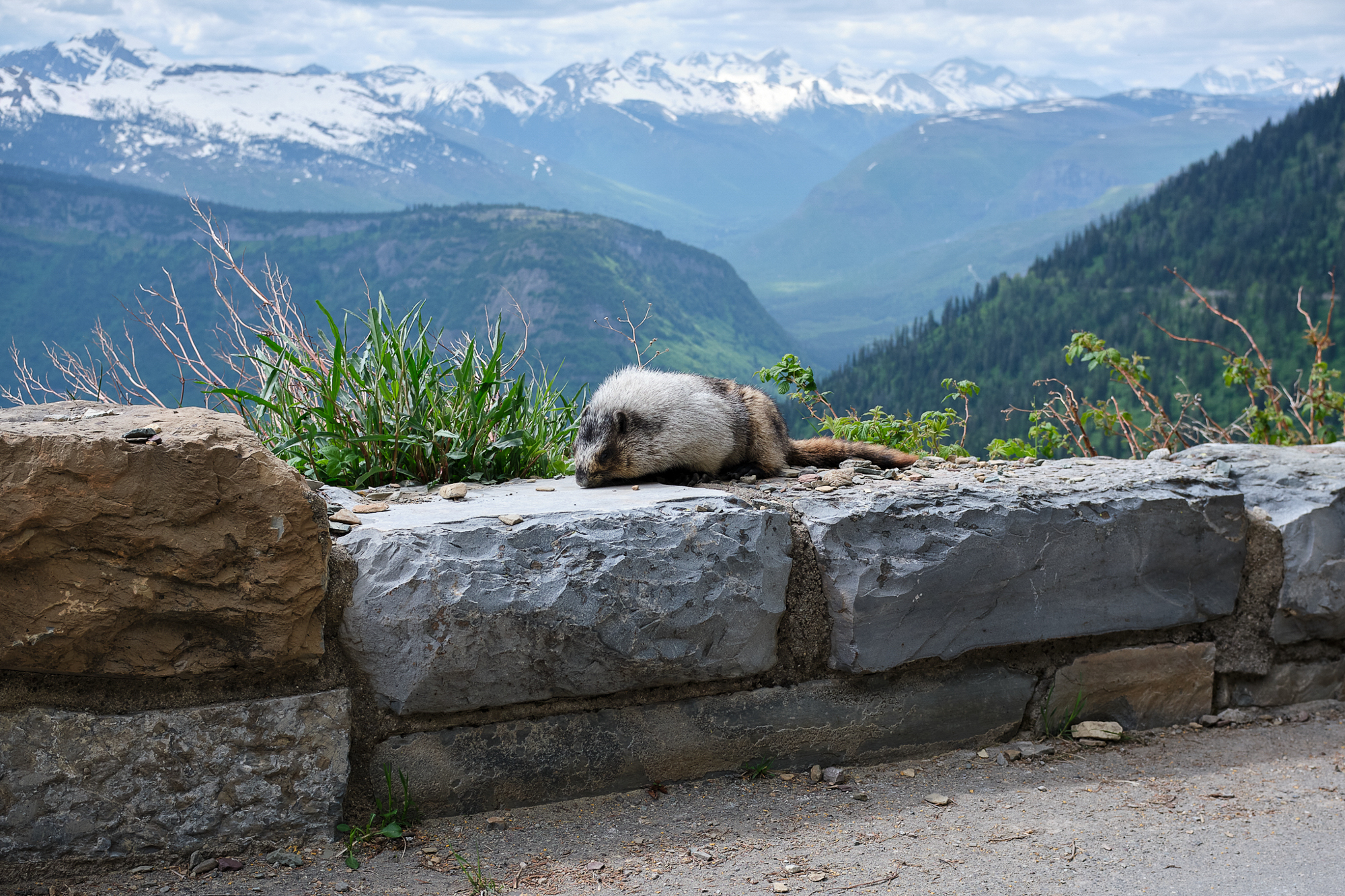
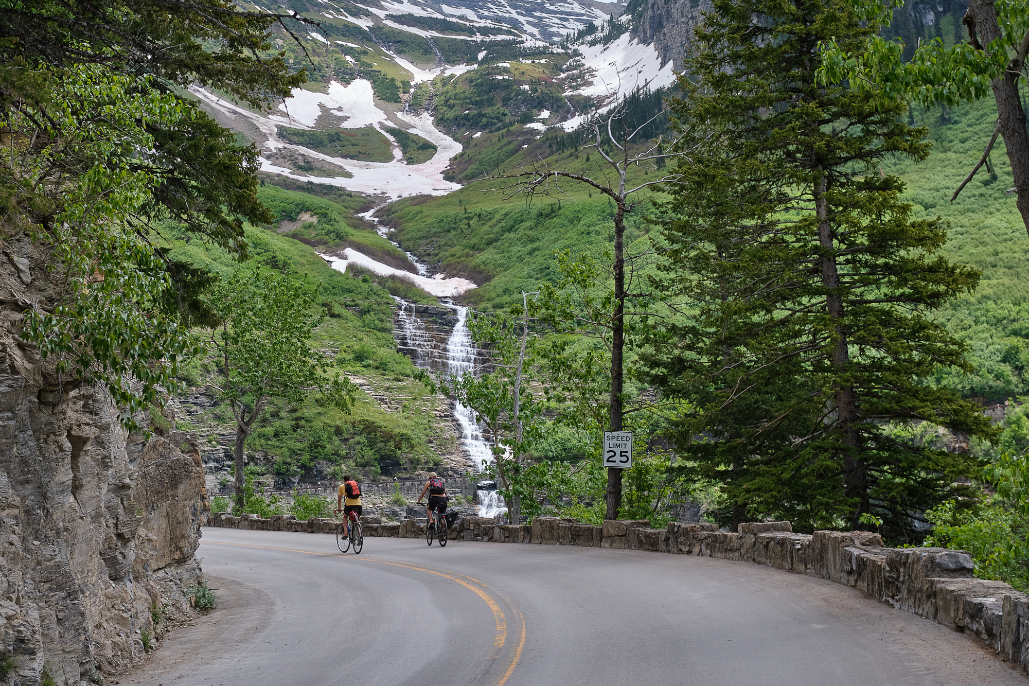
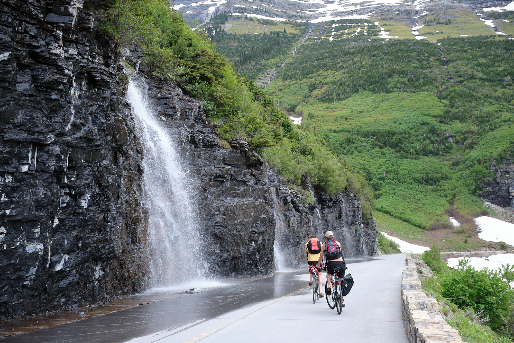
At Big Bend, elevation 5,700, tall snowdrifts flanked the roadside. This was another popular stop for riders and bighorn sheep. Big Bend is just past the Weeping Wall, a cliff along the inner side of the road that rained spring snowmelt.
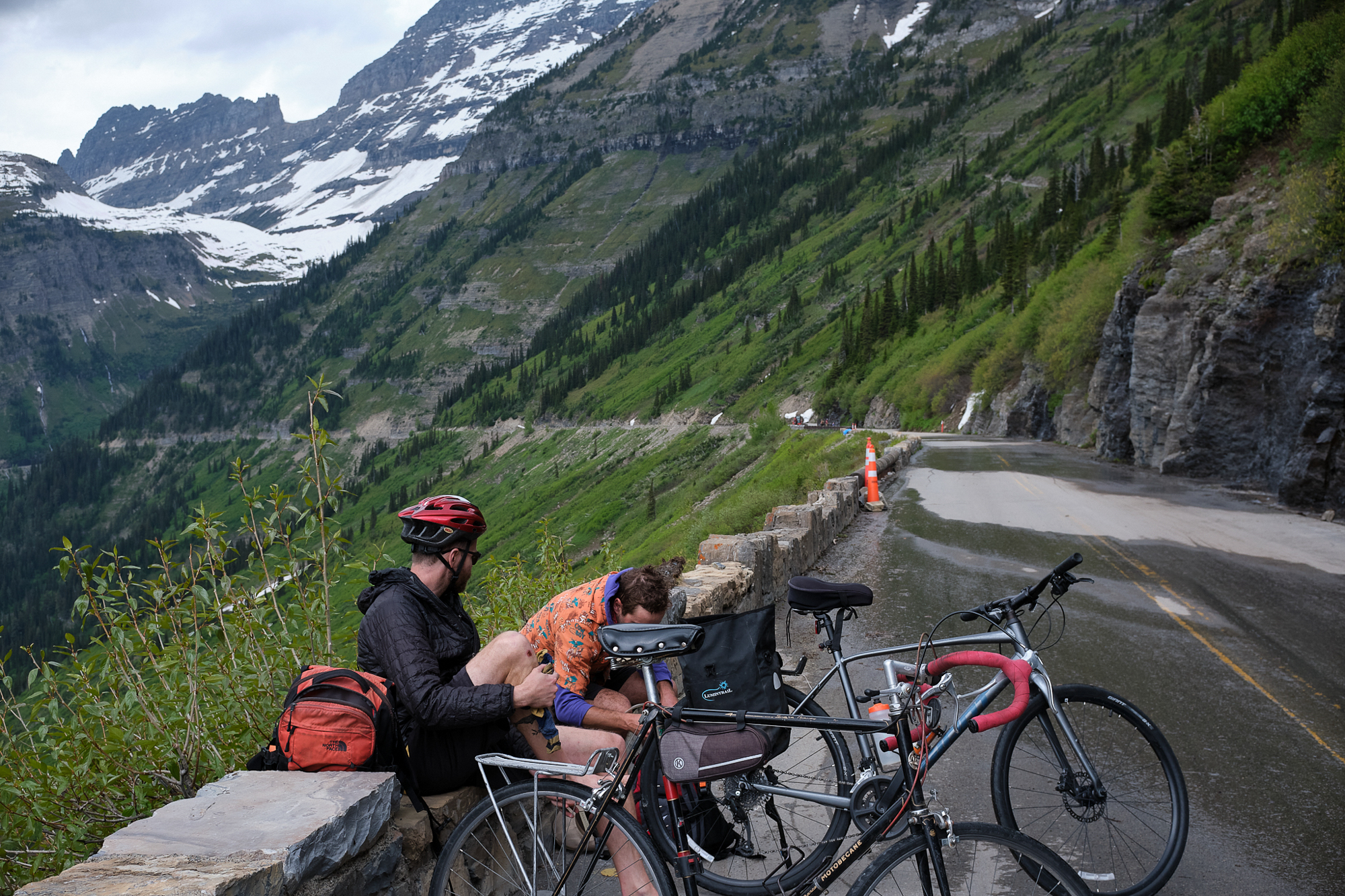
We got just inside of a mile from Logan Pass, our goal, when we met the ranger making his way down. It was the end of the line at just over 6,300 feet and 15 miles. I didn’t mind. We put on our jackets for the descent – a necessity both for the temperature difference and after sweating for the entire ride upward.
The descent was sublime. The grade is such that your speed doesn’t get carried away too quickly. The cautious rider can lightly ride the brakes and stay comfortable. The daredevil can go all out with a few well-timed pedals. I kept it between 20 and 30 mph and tried to savor the views. The final five or so miles is a nice treat, flattening out a bit at the valley floor but still descending. You’re pedaling easily, chatting and still hauling ass.

Roads are for Everyone
There’s something special about riding a closed road. Without the constant threat of vehicles, there’s really no need to take the lane. It’s yours. Acknowledging an entire political discussion about who our public roadways serve (and don’t serve), it’s joyous to see an automobile roadway that’s full of bicycles. The traffic doesn’t ever jam.
One of my favorite recurring closures was at Lilydale Regional Park in St. Paul. Spring flooding from the Mississippi River closed the road for vehicle traffic and opened up the ability to meander about the trails and roadways unencumbered. Springtime at Lilydale is alive with lush vegetation, bikes, birds, and bugs before the trail rises up and out for a scenic view of the river.
On Going-to-the-Sun Road, that joy was multiplied. It felt sort of amazing that the park even allowed this kind of thing. And to be out with so many other cyclists riding the Crown of the Continent added to the feeling, even though the crowds made me think about the future. The explosive growth in vehicle traffic added layers of complexity to park visits. You can imagine the same happening to the bike ride one day. I’m glad I got to take the ride when I did.
I left to go home on a Sunday morning. Wildfire smoke had moved into the area, bringing haze and smell – another major change impacting the Montana outdoors. And of course, there’s the fact that Glacier National Park’s glaciers may soon disappear due to climate change. Those more existential threats give new meaning to an old Montana state motto: The Last Best Place.
In that sense, it would be a shame to discourage any cyclist from this ride. Old bike, new bike, mountain bike, custom build, box store bike, $10,000 racing bike, e-bike: Go get some.